
Rationalizing the use of chemicals in the field to optimize resources and reduce environmental impact.
Drones: mapping and spectral indices (NDVI, LAI) as support for the development of prescription maps.
Preserving the chemical and physical characteristics of the soil, ensuring its quality, and increasing biodiversity.
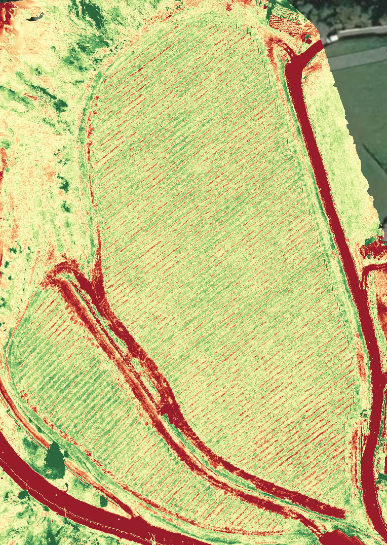
MULTISPECTRAL IMAGES
We integrate data from satellites (hyperspectral) and surveys conducted in the field by our specialized drones (multispectral). Following the processing of these images, it is possible to visualize useful indicators of the plant's health: NDVI (Normalized Difference Vegetation Index) shows the difference in vigor of various areas of the vineyard, while NDWI (Normalized Difference Water Index) is an index of water stress. These indicators are displayed in the form of maps that are easily interpretable by the human eye, thanks to selected color scales.
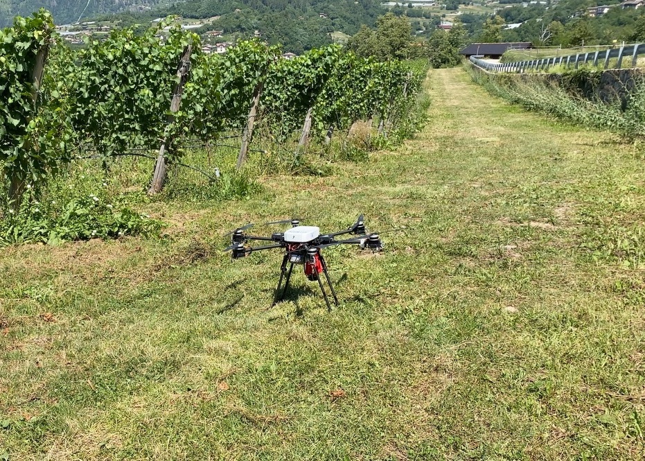
DRONES
Drones are the most effective means to obtain a precise, high-resolution view of what is happening in the field.
Our certified UAV operators safely pilot drones of various sizes, from the 900-gram commercial DJI Mavic Pro to larger
aircraft, 1 meter in diameter. HERMES-00 is a hexacopter designed and built in collaboration with the
Department
of Industrial Engineering (DII) at the University of Trento. It features a geolocation system
with RTK correction that, interfacing with the territory's base stations, guarantees
centimetric-level accuracy.
We use different types of cameras, both RGB and multispectral, to gather valuable information about
the health and mapping of the field.
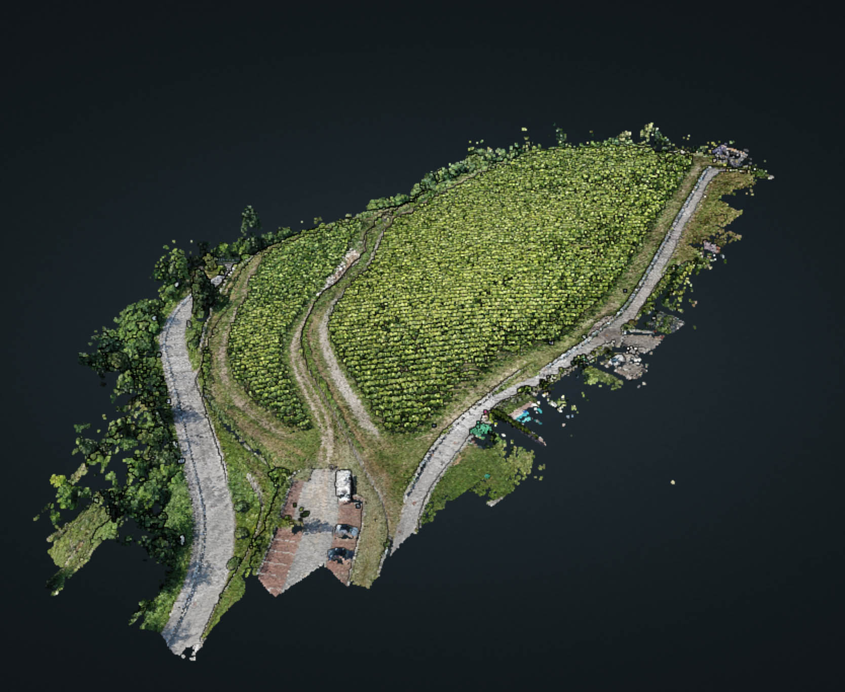
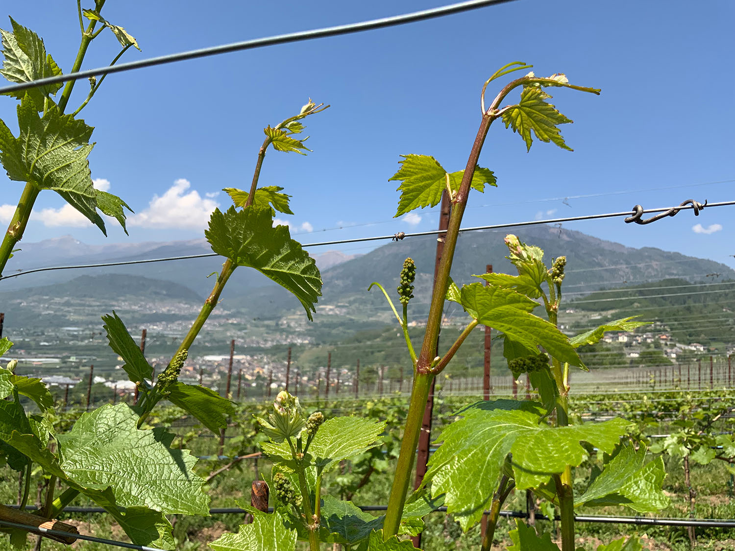
FIELD MAPPING
Our image processing systems, combined with the precision GPS of our drones, allow
us to develop not only vegetative indices (NDVI) but also RGB 3D models and define field or plot perimeters.
From these georeferenced data, it is possible to create prescription maps: the field is divided into smaller
areas based on the actual amount of water or fertilizer required. Knowing the right quantity to apply to each zone
makes it easy to efficiently manage resources, reduce waste, and save costs.
The extreme importance of mapping one's own land, giving spatial and temporal value to the data
acquired daily, becomes understandable. Only in this way the winemaker can modulate every intervention according
to the actual needs.
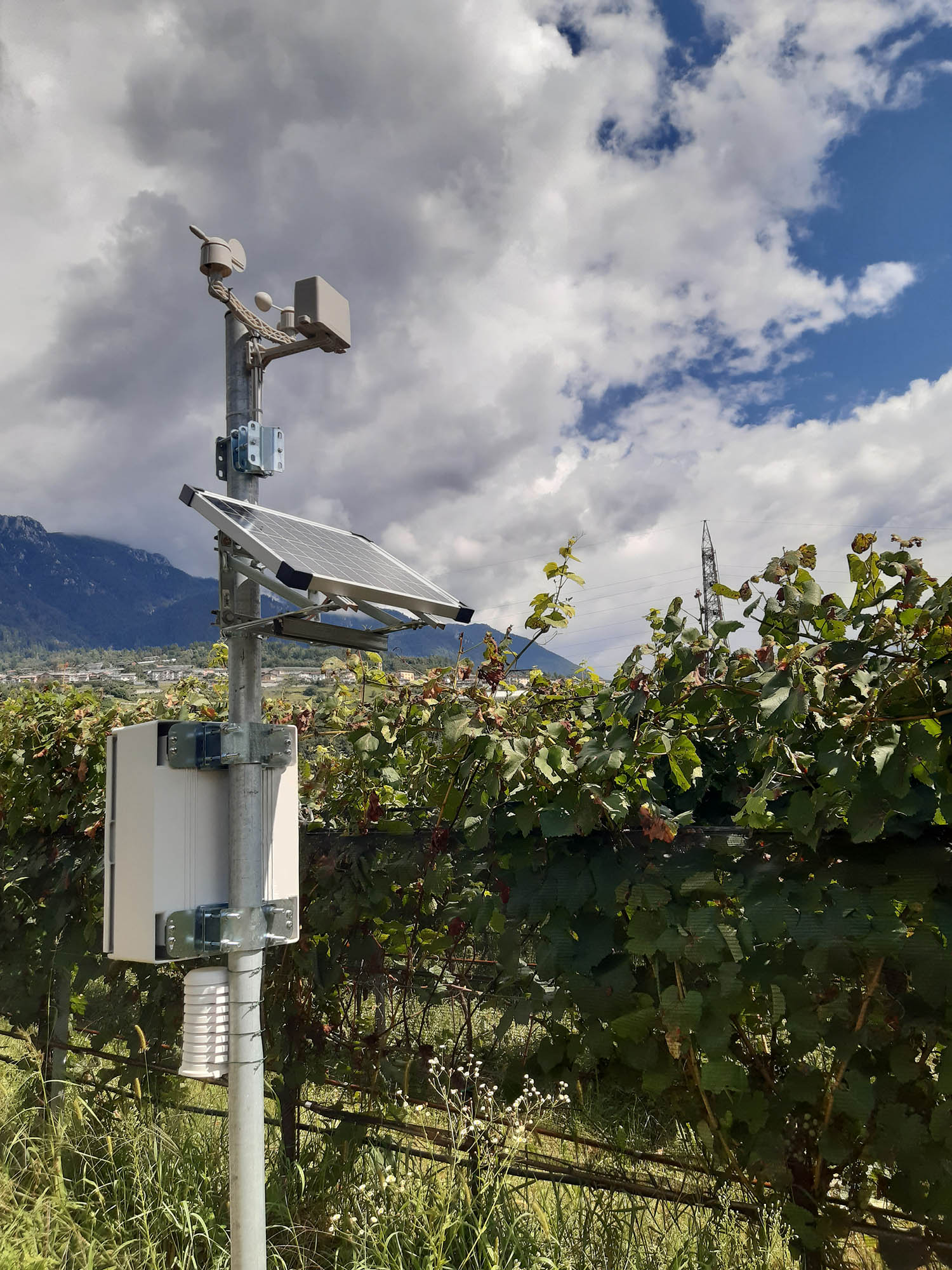
SENSORS
The installation of field sensors, both meteorological and more specific for vine monitoring, is a fundamental
activity for innovation and "digitalization" in agriculture.
Sensors allow us to collect a large amount of data useful for assessing the health status of the crop
and subsequently for planning targeted interventions.
Racemus.ai leverages data acquired from a network of low-power wireless sensors designed
and integrated by our technicians. It includes sensors of various types:
- Weather stations.
- Soil moisture and temperature sensors.
- eaf wetness and temperature sensors.
The data is accessible on our platform, along with an always-available historical record.
We also use historical data for the development of predictive models.
PREDICTIVE MODELS
Predictive models not only provide important decision support to winemakers and agronomists
but also help implement targeted interventions to save resources and safeguard the crop.
The combination of data from various sources, along with knowledge of the state of the art
in viticulture, has allowed our experts to develop customized algorithms capable of predicting:
- The development stage of the vines (phenological phases).
- The risk of downy mildewpathogen development.
Predictive models are integrated with alert systems (notifications and dedicated dashboards)
that allow the farmer to prepare the right interventions before the event occurs.
Contact us for further information.
Write to us at the address info@racemus.ai.
ALL FEATURES
Field mapping
Identification of vineyards and individual cultivars represented through polygons on satellite map.
Drone imagery
By using drones in the field, it's possible to develop 3D and 2D models of vineyards, surface (DSM), and terrain (DTM), with centimeter precision, thanks to RTK systems. Downloadable in various formats.
Vegetative Indices from drone
Dashboard dedicated to consulting vegetative and vigor indices obtained through the processing of multispectral maps generated by drones: NDVI, ENDVI, vNDVI, VARI, EXG, TGI, BAI, GLI, GNDVI, GRVI, SAVI, MNLI, MSR, RDVI, TDVI, OSAVI, LAI, EVI. Different colors can be applied, and files can be downloaded in various formats.
NDWI Water Index
Satellite images with water stress index (NDWI) provided by Sentinel-2 with a resolution of 10 meters, every 5 days.
Ripening Indices
Calculation of ripening indices based on data collected through the meteorological station installed in the field or the nearest one to the vineyard. Historical data of nine different types of indices are available for each season, useful for multi-year comparison, as well as a real-time graph updated daily of Winkler and Huglin indices.
Weather Station
Field-installable weather station with sensors useful for viticulture: temperature, humidity, wind speed and direction, solar radiation, rainfall, atmospheric pressure. Data is available in real-time and historical mode.
Field sensors
Possibility to install sensors directly between the rows: leaf temperature and wetness, volumetric water content and soil temperature. As well as an innovative sensor installed directly on the vine leaf that monitors its water content. Data is available in real-time and historical mode.
Weather forecast and climograph
7-day weather forecasts updated every hour for each field: weather icons, minimum and maximum temperature, perceived temperature, wind direction, gusts, and speed,
hours of sunshine, mm of rainfall, precipitation probability (%), hourly rainfall, distribution of precipitation in 20 km,
relative humidity.
Also available Walter - Lieth climograph.
QR code
Generation of a dedicated URL for each harvest with information on the progress of the vineyard season. Each page will have an associated QR code, which can be printed, downloaded, and shared.
Decision support
Thanks to the set of manually entered or instrument-collected data, it is possible to offer a "Decision Support System" (DSS), which helps the winemaker through notifications, suggestions, and forecasts, to act in the most correct and timely manner.
Predictive models
Predictive models of various stages of downy mildew development and vine phenological stage.
Racemus Classifier
The Racemus.ai classifier is a tool developed through machine learning models that allows distinguishing a healthy leaf from a diseased one.
Data entry
Possibility to manually enter data: treatments, field operations, irrigation, chemical analysis, phenological phases (with photos), and harvests, pesticide database, adversities, specific cultivar and vineyard data.
Calendar
A navigable calendar allows for a temporally organized view of data: phenological phases, harvest, and operations, all on one page.
History and charts
Free consultation of the historical data of the various viticultural years present on the portal, with the possibility of viewing combined and non-combined graphs. The general dashboard contains data for the current and real-time season.
Accessible anywhere, even in the field
The visualization of the Racemus.ai portal is adaptable based on the device it is used on, so it is possible to view and enter data from a computer, as well as from a mobile phone directly in the field.
Racemus.ai was born from a research project funded by the Autonomous Province of Trento, with the goal
of combining advanced technologies and tools with traditional vine cultivation methods.
At the center of it all is the winemaker, who can benefit both in terms of field management and decision support.
Among the main activities are environmental monitoring and water control in the wine sector, aimed at increasing
agricultural sustainability and product quality.
The project has seen important collaborations with local entities, including the University of Trento and the
Edmund Mach Foundation, a research, training, and experimentation center in the agricultural and environmental field.
The home of these studies is Trentino, a land dedicated to viticulture with over 10,000 hectares of vineyards.
See our GIT repository for more details.